Slantrange - crop management on an industrial scale
Технологии управления урожаем являются естественным развитием аграрных практик в растениеводстве. Более того, этот путь практически неизбежен в условиях изменений климата, сокращения посевных площадей и роста цен на семенной материал, оборудование и агрохимию.
According to my personal experience, the agricultural sector, which produces a resource that is guaranteed to be in demand, now attracts not only specialized specialists, but also engineering personnel who strive to fill new markets. Many ideas are put forward, from automation of existing processes to the latest fully autonomous agricultural enterprises. But crop management technologies are a new concept in crop production, which will require both new methods of agriculture and the introduction of new equipment for their implementation.
UAVs of the mini class are universal and cheap assistants for the farmer
In plant growing, many parameters can arbitrarily change in wide ranges during the vegetation of plants. So, for example, in the case of open ground, such parameters as the temperature regime and the amount of phytoactive radiation are not controlled by humans. The situation with pests and weeds is also not simple, considering, among other things, the cost of the protective means themselves. With today's current prices for agrochemicals, the maximum profitability of production can be achieved with differentiated cultivation of crops, when fertilizers and protection agents are not applied "in full", but only where it is expedient. With regard to fertilizers, such an approach can be implemented during the modernization of ground equipment, but for protection means, everything is not so simple - pests come without demand and where it is convenient for them. Special means of remote monitoring will be able to effectively supplement the agronomist's toolkit. Historically, it happened that in Europe and Asia, a significant percentage is occupied by small farms, with fields up to 50-70 hectares, such small fields can be surveyed with a smallUAV, for example such like the DJI Phantom. Spectral data have relatively small volumes and can be effectively processed by existing cloud services. The measuring mode for such spectral equipment is not fundamental - it is quite possible to reach the identified problem areas and use the available classical instruments.
If you focus on universal and cheap UAVs of the mini class, one of the main requirements for sensor systems is miniaturization and minimal mass. Many manufacturers sought to fill the resulting niche, and there is a whole line of different models on the marketSentera,MAPIR and others considered in previous articles.
Technologies for large areas
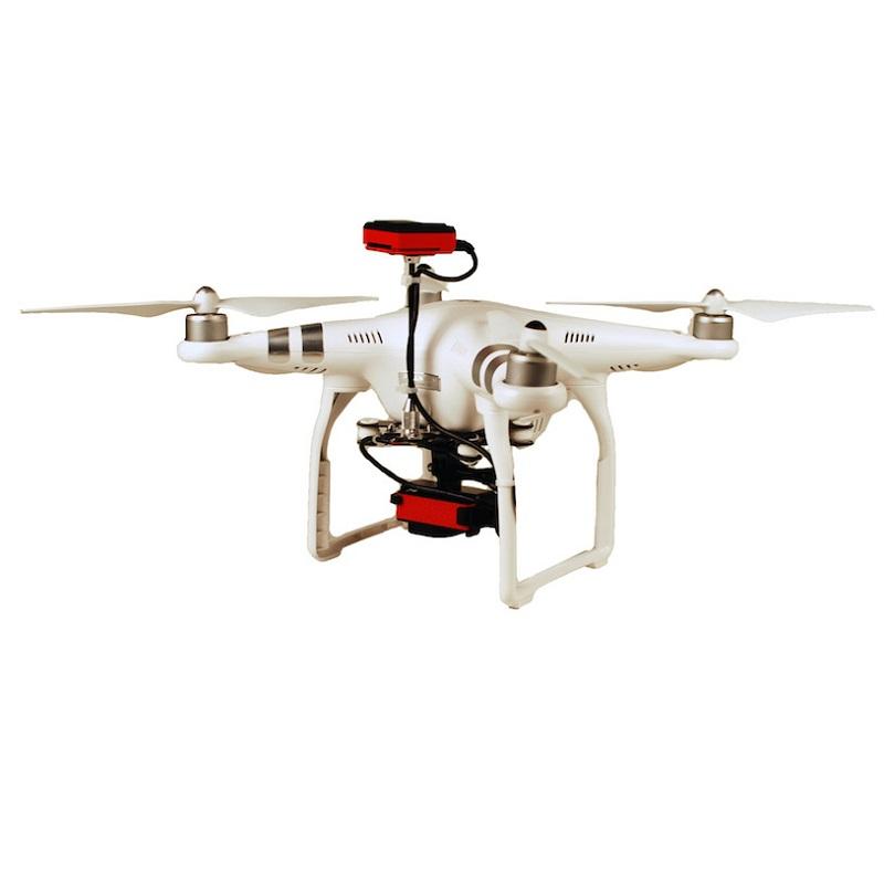
In the post-Soviet space, the situation is different, a farmer's land bank of several thousand hectares is not something exceptional. Accordingly, a special apparatus capable of flying around the square on an industrial scale is required. There are also other requirements for spectral equipment - the measuring mode is mandatory, since the agronomist is physically unable to bypass all problem areas. The measurement mode can be provided by taking into account changes in sunlight, which can be achieved using ground-based optical templates or specialized sensors. For small fields, optical templates are applicable, and for large areas, an anti-aircraft sensor is preferable. As an example of such equipment, we can cite the Parrot Sequoia system, in which, in addition to the main camera unit, there is also a special sensor that is attached to the top of the device.

The Parrot Sequoia system is mounted on the base of the DJI Phantom UAV
The Slantrange complex - additional possibilities
If you still cannot do without a more powerful UAV capable of flying over hundreds of hectares at a time and a special device is required, then it is quite realistic to not chase the miniaturization and minimum mass of the measuring complex, implemented in no additional functions.
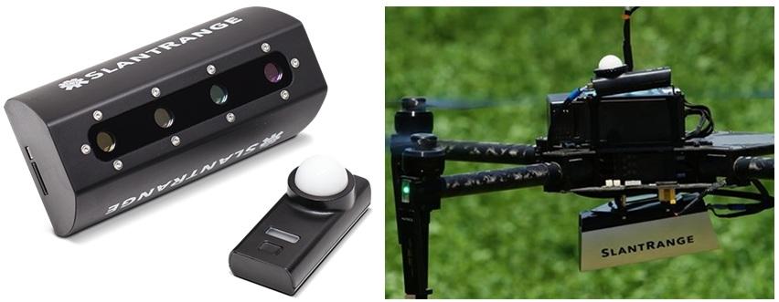
Large fields are typical for the USA and Canada, precisely for industrial scale, and a fundamentally new Slantrange complex (USA) was developed.

Slantrange complex

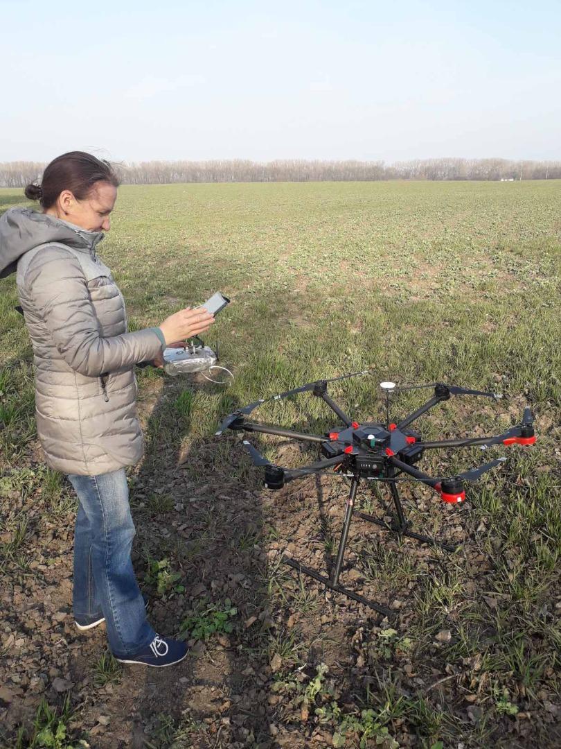
Slantrange complex in field application .
Unfortunately, information about almost all new equipment on the market is primarily of an advertising nature. Such epithets as "innovative", "breakthrough", etc. are not considered unusual for readers, nevertheless, we will try to understand why the Slantrange complex can really be considered an outstanding solution.
The highlight of the Slantrange complex is that it was methodologically created specifically for crop management technology, and was not a clone of satellite technologies. To achieve these goals, both technical and programmatic solutions were taken.
Modern practices in plant growing include feeding and the introduction of plant protection products directly in field conditions at certain stages of vegetation. That is, for the differentiated application of agrochemistry, it is necessary to ensure the receipt of information, its processing, the interpretation of the obtained results and the introduction of reagents. All this is complicated by the fact that time is strictly limited (on average 7-10 days), and the growth of plants is determined not only by the agronomist's plans, but also by weather conditions, which are by no means stable from year to year. Ideally, it is desirable to fly constantly, although this does not cost a lot of money, but it requires organizational efforts, which households do not willingly do. Therefore, agronomists try to give an order for departure when the plants are already in the right stage of vegetation - hence, a typical delay in departure for several days. Certain weather conditions are necessary for shooting. In the case of satellites that do not work when it is cloudy, everything is complicated. UAVs can also work under clouds, but uniform illumination is extremely desirable for them too - that is, suitable conditions for shooting can be limited. For this reason, for crop management, the time required for obtaining and processing information must be minimized.
In today's market systems for multispectral surveying using UAVs, the approach to processing information is taken from satellite technologies, when the data (received pictures) are uploaded to the "cloud" via the Internet, where their further processing takes place. For satellite technologies, such a solution is quite obvious - there are not so many antenna complexes necessary for communication with satellites, and they, of course, have a developed infrastructure of communication means. But in field conditions, where there is only mobile Internet, the transfer of tens of gigabytes of information will not be an easy task. In addition, the remote processing of information in the cloud causes certain concerns for the owners, since there remains the possibility of unauthorized access to this confidential information by outsiders.
For autonomous data processing, directly in the field, the Slantrange developers created their Slantview software, which can work autonomously without internet. Other developers also had such solutions, but the highlight of the Slantrange was the integration of the computing unit directly into the sensor system mounted on the drone. For large areas of hundreds of hectares, the flight time takes several hours, and some simple but voluminous calculations can be done directly in the air. Thanks to this, on the ground, the data for the final calculation is loaded from a flash card to a PC, and ready results can be obtained within a few tens of minutes. True, such a result requires powerful computers, which are presented on the market in a wide range.
From personal experience
Based on personal experience, a field of 80 hectares was calculated within an hour after planting, although instead of the recommended Core I7 processor, only Core I3 was available. However, even such a result impressed the farmers. The chief agronomist promised to provide a more helpful computer on the next trip. With such speed of processing, it is possible to actually bring the equipment into the field on the day of the flight. This possibility is provided by the developers of the Slantview program, where, in addition to the standard files of the geotiff (directly on the PC) and kmz (used in Google Maps Internet applications) format files, the obtained survey results (index cards) can be saved in the Shape format. The files of this extension are used to create presets directly for the ground equipment.
So what can be said about the hardware part of the Slantrange complex:
- The possibility of processing spectral data directly in flight;
- The image stabilization system does not require a special suspension, which is relevant for most models of UAVs, especially airplanes;
- Highly effective mapping during mapping, thanks to which it is enough to have 20% overlap of images to obtain an index map in the SlantView software product.
There are alternative solutions, but the highlight is the software...
The result is good, but, in principle, it is also achievable when using the second equipment Data processing "on the spot" will be longer, but this is not essential. Especially since large computing power can be organized without considering energy consumption, weight and dimensions. Hardware systems for the stabilization of spectral equipment have been used for a long time, although they complicate and make the systems heavier. The small value of the minimum lateral overlap of the images is undoubtedly a great advantage in the conditions of industrial-scale shooting. But in principle, this advantage can be realized due to the use of a larger number of devices. In this case, the cost of the required amount of equipment and time are already the most important parameters. In a word, the hardware part of the Slantrange complex is very decent, in some ways exclusive. But what makes the complex truly outstanding is the SlantView data processing program, developed under the innovative harvest programming methodology. Usually, it is cameras that are described in advertising, although in this case, the main innovations, namely, in software solutions, are what we will devote to themthe following article.
Pasichnyk Natalya Anatolievna (n.pasichnyk@nubip.edu.ua)