/ Agricultural equipment, equipment, inventory / Agricultural equipment, inventory / Systems of precision agriculture / Parallel driving on a tractor, course guide

For sale / buy
Parallel driving on a tractor, course guide, Poltava region.
Price8000 UAH.
Region:all Ukraine,
Poltavskaya region.
Updated:
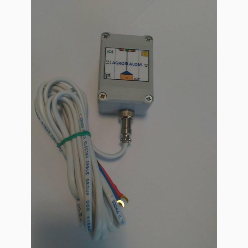
GPS navigator, Agronavigator
High-precisionparallel driving system GPS, this is a professional navigation equipment. The accuracy of the measurements during parallel driving is from 30 to 50 cm. When measuring the field area, it is from 1 hectare.
Ease of use:
The processed part of the field is painted in a second color. Deviation from the correct course is visually visible on the screen, the operator mustalign the tractor in the right direction. Also, the speed of the tractor, the number of satellites, and the area of the cultivated field will be visible on the screen.
It is used on agricultural machinery to perform precise agricultural work on sowing and applying fertilizers and agrochemicals. And also for accurate measurement of the field area.
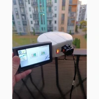
The antenna module works from the GPS satellite system at the L1 frequency, receives a correction signal from 3 EGNOS satellites, the clock frequency is 10 Hz (updating the position 10 times in 1 second), the antenna has an operating frequency of 18 dB, for holding more satellites and more accurate positioning. The GPS module is installed on the roof or on the hood of the tractor (strictly in the center), it is fixed with the help of 3 neodymium magnets on the receiver body, it is powered from the tractor's on-board network in the voltage range from 4 to 30 volts. It connects to a mobile device via Bluetooth wireless technology. The tablet with the software is installed in the tractor, connected to the power supply through the cigarette lighter socket and the system is ready to work.
The accuracy of work from pass to pass, with quality management, is 25-45 cm. This accuracy is enough for spraying, spreading fertilizer, cultivation, harrowing.
The course indicator will allow:
- to carry out work without gaps and covered when applying fertilized crops, spraying,
- work in difficult weather conditions, at night with poor visibility in the fog,
- reduces the cost of fertilizer, seed material and chemicals and the consumption of DT.
The course indicator consists of an external GPS module for accurate positioning combined with an antenna and a Bluetooth module and an application for parallel driving for the ANDROID operating system, which is installed on a mobile device (tablet, smartphone, navigator).
Requirements for the device (tablet, smartphone, navigator): a device based on the ANDROID OS with a screen size of at least 4.3 inches, software version no lower than 4.0.3, a processor of at least 1.2 GHz, RAM of at least 1 GB, the presence of a Bluetooth module.
The software implements:
high speed of updating coordinates;
perspective (3D) display of the workspace;
import of pre-prepared fields;(//tractor-service.com)
area measurement functions;
functions for viewing processing results, exporting results;
two adjustable color schemes for work in different light conditions;
export of processing in KML format and other.
Characteristics:
The accuracy of measurements between rows is from 30 to 50 cm.
Accuracy of area measurement up to 1 hundredth.
Work via Bluetooth wireless interface
The data update frequency is 10 Hz.
External antenna:
- Antenna body - durable plastic, degree of protection IP-65 (full protection against dust and rain)
-Magnetic fastening (a neodymium magnet provides
reliable fixation on metal surfaces)
- Supply voltage from 5 to 30 Volts
- The length of the power cable is 3 meters
-Working temperature: -30ºС + 70ºС
Prices:
1. GPS module + program - UAH 8,000. (if the user has a tablet, the installation file of the program is sent to the mail, or a link to download, you only need to go to the tablet and download the program);
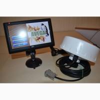
2.GPS module+program+tablet (diagonal screen 7 inches, the set includes a powerful windshield holder, charging from the cigarette lighter socket) - UAH 12,500. (the tablet can be fully used outside the tractor, the program does not block the functions of the tablet).
High-precisionparallel driving system GPS, this is a professional navigation equipment. The accuracy of the measurements during parallel driving is from 30 to 50 cm. When measuring the field area, it is from 1 hectare.
Ease of use:
The processed part of the field is painted in a second color. Deviation from the correct course is visually visible on the screen, the operator mustalign the tractor in the right direction. Also, the speed of the tractor, the number of satellites, and the area of the cultivated field will be visible on the screen.
It is used on agricultural machinery to perform precise agricultural work on sowing and applying fertilizers and agrochemicals. And also for accurate measurement of the field area.
The antenna module works from the GPS satellite system at the L1 frequency, receives a correction signal from 3 EGNOS satellites, the clock frequency is 10 Hz (updating the position 10 times in 1 second), the antenna has an operating frequency of 18 dB, for holding more satellites and more accurate positioning. The GPS module is installed on the roof or on the hood of the tractor (strictly in the center), it is fixed with the help of 3 neodymium magnets on the receiver body, it is powered from the tractor's on-board network in the voltage range from 4 to 30 volts. It connects to a mobile device via Bluetooth wireless technology. The tablet with the software is installed in the tractor, connected to the power supply through the cigarette lighter socket and the system is ready to work.
The accuracy of work from pass to pass, with quality management, is 25-45 cm. This accuracy is enough for spraying, spreading fertilizer, cultivation, harrowing.
The course indicator will allow:
- to carry out work without gaps and covered when applying fertilized crops, spraying,
- work in difficult weather conditions, at night with poor visibility in the fog,
- reduces the cost of fertilizer, seed material and chemicals and the consumption of DT.
The course indicator consists of an external GPS module for accurate positioning combined with an antenna and a Bluetooth module and an application for parallel driving for the ANDROID operating system, which is installed on a mobile device (tablet, smartphone, navigator).
Requirements for the device (tablet, smartphone, navigator): a device based on the ANDROID OS with a screen size of at least 4.3 inches, software version no lower than 4.0.3, a processor of at least 1.2 GHz, RAM of at least 1 GB, the presence of a Bluetooth module.
The software implements:
high speed of updating coordinates;
perspective (3D) display of the workspace;
import of pre-prepared fields;(//tractor-service.com)
area measurement functions;
functions for viewing processing results, exporting results;
two adjustable color schemes for work in different light conditions;
export of processing in KML format and other.
Characteristics:
The accuracy of measurements between rows is from 30 to 50 cm.
Accuracy of area measurement up to 1 hundredth.
Work via Bluetooth wireless interface
The data update frequency is 10 Hz.
External antenna:
- Antenna body - durable plastic, degree of protection IP-65 (full protection against dust and rain)
-Magnetic fastening (a neodymium magnet provides
reliable fixation on metal surfaces)
- Supply voltage from 5 to 30 Volts
- The length of the power cable is 3 meters
-Working temperature: -30ºС + 70ºС
Prices:
1. GPS module + program - UAH 8,000. (if the user has a tablet, the installation file of the program is sent to the mail, or a link to download, you only need to go to the tablet and download the program);
2.GPS module+program+tablet (diagonal screen 7 inches, the set includes a powerful windshield holder, charging from the cigarette lighter socket) - UAH 12,500. (the tablet can be fully used outside the tractor, the program does not block the functions of the tablet).
|
Store, contacts | |
Oleg/ отзывы, инфо./ activity assessment | |
|
Phone:
+38 xxxxxx
show
| |
All user ads ~50 | |
Ad ID: #959879
(added by a registered user, registration date: 09-17-2019)
Добавлено / Обновлено: 14-09-2026 10:20 (current, until: 14-09-2027)
Permanent ad address:
Showed / watched for today: ?, total: ?
Similar ads
Among them there are many interesting...
Filters: Parallel driving systems




All Ukraine: Agricultural equipment, equipment, inventory 45593 / Agricultural equipment, inventory 1552 / Systems of precision agriculture 113
Poltava Region: Agricultural equipment, equipment, inventory 2404 / Agricultural equipment, inventory 102 / Systems of precision agriculture 1